The campaign for
River Access for All
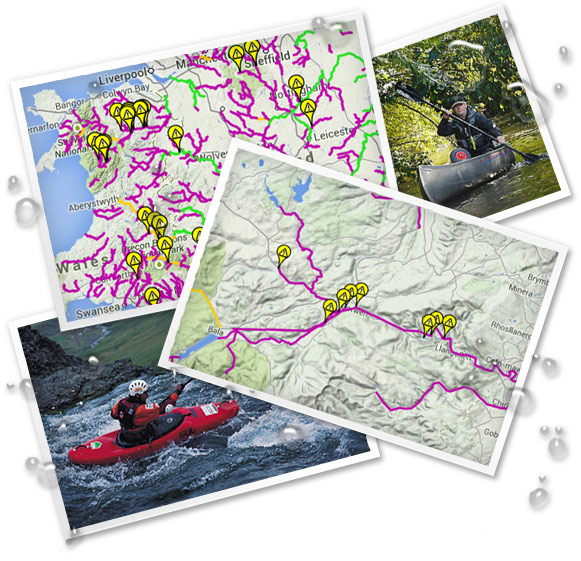
Access Map
The access map has been created to spread information on a river by river basis.
It shows which rivers are universally accepted as having a right of navigation and which have "access agreements" (sometimes for only one day a year), evidence for historic use of the rivers from the research of Douglas Caffyn and others and feedback from those that use them now.
Without more widespread input from those with local knowledge it can never hope to achieve its full potential.
Do you know anything that would strengthen the evidence for a public right of navigation? Have you got knowledge of local incidents? Even if you and others can generally paddle without problems of any sort that is valuable knowledge so tell us on The Access Map.
Have you got knowledge of local incidents? Even if you and others can generally paddle without problems of any sort that is valuable knowledge so tell us on The Access Map.
Even if you and others can generally paddle without problems of any sort that is valuable knowledge so tell us on The Access Map.